Motorcycles
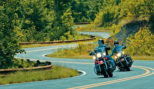
The terrain in Western Arkansas’ Mountain Frontier makes for thrilling motorcycling adventures and rallies, including the Steel Horse Rally in April. The Boston Mountains Scenic Loop consists of U.S. 71 and I-540 with exciting twists and turns through the stunning mountain landscape. Follow U.S. 71 to Scenic Hwy. 23 for a jaunt across Arkansas’ Wine Country. Mount Magazine Scenic Byway (Ark. 309) offers spectacular views of the state’s highest peak. Continue south on U.S. 71 to the Talimena National Scenic Byway (Ark. 88) for panoramic views of the Ouachita Mountain countryside and beautiful Queen Wilhelmina State Park.
Scenic Spots
Artist Point
Known as "The Grand Canyon of the Ozarks." Located on Scenic Byway 71, 8 miles north Of Mountainburg.
Highway 282
Begins in Mountainburg at its junction with Scenic Byway 71 and continues eight miles to rejoin 71.
Mount Magazine Scenic Byway
Ark. Hwy. 309, a National Scenic Byway, winds to the top of Mount Magazine. Overlooks show the valleys and lakes of Logan and Yell Counties.
Natural Dam
An easily accessible waterfall. Located 15 miles north of Van Buren. Breathtaking views. Picnic areas.
Ozark Bridge
Scenic Hwy. 23, spanning the Arkansas River, has been called one of the 16 prettiest bridges in the nation.
Reed Mountain Park
Hwy. 64 east of Ozark, overlooks the Arkansas River and the Ozark-Jeta Taylor Lock and Dam.
Scenic Highway 22
Beautiful route takes you by Subiaco Academy and other points of interest as it travels west from Dardanelle through Paris and Charleston into Ft. Smith.
Scenic Highway 23
A National Scenic Byway connecting from Hwy. 71 south of Booneville, northward from Ozark to its junction with Ark. Hwy. 16. The Byway is known as "Pig Trail" to Razorback football enthusiasts.
Scenic Byway 71
Travels north of the Arkansas River through the Boston Mountain range, highest peaks in the Ozark Mountains.
Scenic Highway 186
State scenic highway off I-40 travels through Arkansas Wine Country and connects with U.S. Hwy. 64 in Altus.
St. Mary's Mountain
Take Altus exit 41 off I-40 to Hwy. 186 for a drive past vineyards, wineries and St. Mary's historic church.
White Rock Mountain
North of Mulberry and east of Mountainburg. This Franklin County peak near Scenic Hwy. 23 is one of the tallest in the area.
Talimena National Scenic Byway
Extends 54 miles from Mena to Talihina, Oklahoma, offers breathtaking panoramas of the surrounding countryside from peaks of nearly 3,000 feet.
U.S. Scenic Highway 64
The route runs parallel to I-40 from near the Johnson County line east of Clarksville to Ozark in Franklin County.